 F4LUFTBILDER
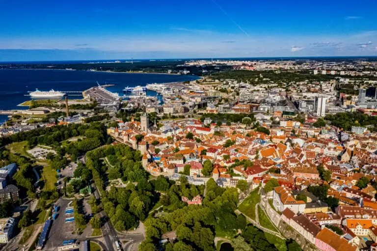



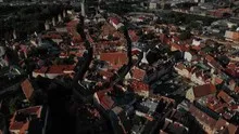
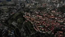
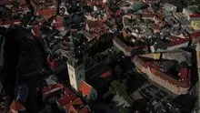
Tallinn and its dense old town
The narrow streets and dense roofs of the old town stand out above Tallinn. Towers emerge from the buildings at intervals. In the further view, the water on the Estonian coast appears and places the historical cityscape in a much larger space.
The old town from two distances
Across Tallinn the proportions change from the small old town roof to the wide harbor area. The striking towers help to find the old town center in the larger coastal city.
The gaps between the houses reveal how tightly built the place is. An inner courtyard opens up the roof structure, a treetop covers part of it, and a wide street separates two blocks. Anyone who looks at the photo can follow these gaps and get a clearer picture than if they tried to identify each building individually. A particularly suitable view for a city portrait is one in which the view from a clearly visible roof can move on to the neighboring streets.
How a tower dictates the direction of view
Up close, a tower draws the eye upwards. In the aerial photograph this movement is reversed. From the top, the eye follows the sides down to the ground and finds paths, neighboring buildings or vegetation for size comparison. A steep perspective shortens the visible shaft. When viewed from the side, it stands out from its surroundings. When selecting a representative image, it is therefore crucial whether the shape of the tower or its location in the terrain should be shown.
The water between the quay edges
In a harbor, the individual areas are best seen from the water. A pier delimits the entrance, straight edges frame a pool, smaller footbridges divide the area. Boats and ships provide an indication of size without an exact distance being able to be derived from the image. The shape of the harbor provides an overview. A closer look at the edge of a quay, on the other hand, shows how the water directly connects to the landside paths, buildings or open spaces.
Warm tones within the series
To switch between two of the 24 aerial photos, shot 24 and shot 2 can be called up directly in the gallery. In the second view, warm reds and browns have more weight than in the first. Red-brown and yellowish areas are particularly noticeable next to cooler surfaces. What is interesting when comparing is whether they are concentrated on a single object or appear spread out across the entire view.
Shot 1 and Shot 24 are among the views from July 12, 2019. According to the camera's time information, there are approximately 14 minutes between the two images. The exposure time was 1/1250 second for the first of the images mentioned and 1/1000 second for the second.
In the Aerial Videos section there are 7 clips for this article. An example is “Tallinn in Estonia filmed from the air in 4k”. Its preview leads directly to the video in the aerial photographer's Adobe Stock portfolio.
Prepare a cityscape for readers
For a city history, it can be informative to place the aerial photograph next to a street view. In one picture the roof is the reliable reference point, in the other it is often the entrance or the facade. The transition is best achieved via a corner, a square or a visible junction. An aerial photographer can take this connection into account when taking photos. In the printed photo series, a brief note about which side of the street the next photo was taken from is often enough.
Related motifs in the aerial photo archive
Two additional views can be used in the archive for comparison. The first can be found under Poland – Leba & Gdansk. This Polish series connects two different places. The second belongs to the article Bautzen. In Bautzen, towers, roofs and larger assemblies are staggered above the lower terrain.