 F4LUFTBILDER
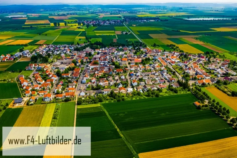


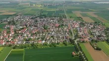
Beienheim as an island in the fields
In the views of Beienheim, the houses form a closed figure between fields of contrasting colors. A road leads almost straight out of the town. It gives the view an introduction before it gets lost between courtyards, trees and the narrower residential streets.
The line from the field to the town
For Beienheim it is worth comparing the field strips with the size of the built-up core. A single field already takes up a lot of image space. This comparison is particularly informative for readers who know the Wetterau but have not yet seen the place itself.
The center of a town can often be recognized from the air by the intersection of several streets. These lines diverge towards the open landscape, the properties become longer and the distances between the houses become larger. Anyone who chooses an image for a location portrait can pay attention to these transitions. A motif with a piece of the surrounding area tells where the place is. A narrower shot, on the other hand, gives people who live or have lived here more opportunities to find familiar buildings in the picture.
Field boundaries as a benchmark
From a greater height, the field appears to be an orderly floor plan. A closer look shows how the paths change direction at curves, embankments and property boundaries. When selecting images, it is helpful to preserve at least one of these transition points. It turns a colored area into a piece of actually used landscape. For an article about the surrounding area, even the inconspicuous edge of a field can explain more than a wide section that only shows numerous plots as small spots.
Order along a line
To find your way around an unfamiliar townscape, you can follow a continuous line until there is a noticeable change in direction. It is often only on this path that small junctions or free spaces become apparent. The image section determines how much of this order remains visible. If the beginning of the line remains in the foreground and its destination remains in the back part of the image, a photograph has a clear reading direction even without drawn arrows. It's particularly worth looking at in a portrait format.
Light and dark areas of the image
If you browse through the 5 aerial photos, you can stay at shot 3 and shot 4 for a comparison. In the first photo, light and dark areas are closer together in tonal value. In the second shot the contrast is more pronounced. When switching between photos, it is worth looking from the lightest area to the dark areas. The greater the distance, the more individual contours can stand out, even in a small preview.
For Shot 5 and Shot 3 the same day is noted in the image files, May 23, 2019. The recording times recorded are less than a minute apart. The exposure time was 1/500 second for the first of the images mentioned and 1/320 second for the second.
A moving view is also available. The clip “Beienheim in Hesse from above” can be found under Aerial videos. The linked preview leads to inclusion in the aerial photographer's portfolio on Adobe Stock.
A townscape for chronicle and community
Anyone who wants to show their family their place of origin often first looks for their own house in the aerial photo. When publishing for the community, the task is different. Even a non-local reader should be able to easily follow the path from the core to the landscape. An aerial photographer can start from the same terrain for both purposes and choose the section differently. What counts for the family portrait is the recognizability of a specific property. When it comes to the townscape, however, it is worth adding a little more surrounding area, even if it means that the individual roof appears smaller.
Related motifs in the aerial photo archive
If you are looking for related motifs, you can start with Bisses. The aerial photos of Bisses show many treetops between the houses. It's worth taking a second look at Berstadt. Berstadt stands out in the overview due to its densely built-up core and the longer rows of houses towards the outside.