 F4LUFTBILDER
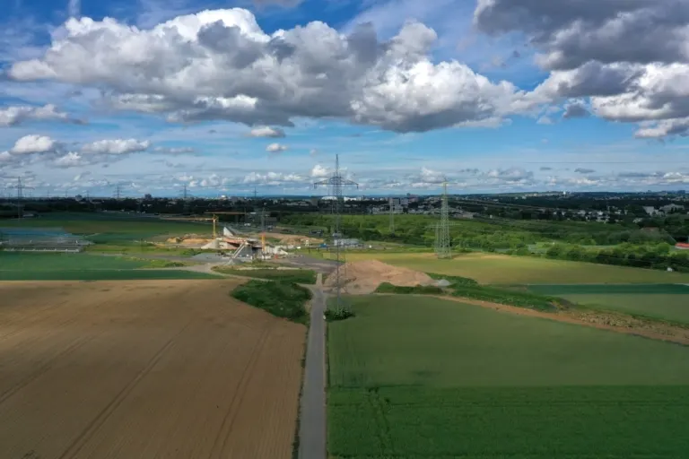


Route between fields and the outskirts of the city
At Eschborn, the course of the regional tangent west can first be recognized by the breaks in the green. A bright working strip runs through the plots. At the crossing with the road, embankments, access roads and the width of the construction site become visible.
A construction condition along the route
The road crossing serves as a fixed reference point for comparing two construction phases. The corner of a field is similarly striking at first glance, but can disappear during excavation work. Especially with a longer route, the difference is essential for the assignment of later photos.
A traffic route gives direction to an aerial view. From above you can see where the route is, where it adapts to the terrain and where another path crosses it. An easily recognizable crossing is particularly useful for an illustration. It arranges the section in the larger network and brings together different proportions. A second look along the route can then show how the line from the first image continues into the adjacent landscape.
Field boundaries as a benchmark
On a map, fields become similar areas. In the aerial photo they differ in color, structure and processing direction. A bright dirt path divides two plots, a row of trees interrupts the straight lines. In such places, the size of the open hallway is better understood than by just looking at the horizon. Color changes should initially be left as an observation. Which crop is growing in a field or when it was cultivated can often only be determined from a single photo with additional local knowledge.
Document a construction condition
When it comes to documentation, what matters most is which condition was recorded from which direction. Visible construction areas, paths already in use and open floor areas can be related to one another in the overview image. For later comparison, the chosen perspective should contain a fixed point that can be found even after the work has been completed. A neighboring street is usually better suited for this than a variable stack of materials. An exact statement of the time of recording, if known, is included in every published comparison.
Shades of green in the image
For a direct image comparison, use shot 7 and shot 14 from the gallery with 30 aerial photos. In the first image, green areas make up a smaller part of the section than in the second. It's worth tracking the green areas individually. Only in connection with neighboring forms does it become clear what is in the foreground and what belongs to the more distant surroundings.
According to camera data, Shot 1 and Shot 30 were taken on May 18, 2026. There is a gap of around 6 minutes between the two pictures. ISO 100 and an exposure time of 1/800 second are recorded for both files.
An image for spatial documentation
In the case of a technical system, the direction of view determines which relationships can be explained. The course is clear along a traffic axis, and across it often the connection to the neighborhood. Both questions are valid for a project portrait. The aerial photographer can treat them in separate views. When publishing later, it will help to organize the selection according to these questions. Two visually different images can otherwise repeat the same information, while an entrance, a crossing or the connection to a neighboring property remains incomprehensible.
Related motifs in the aerial photo archive
The article Eschborn offers another perspective. In Eschborn, tall office buildings are surprisingly close to fields. In the gallery Bad Vilbel there is a different focus. The series from Bad Vilbel focuses on an area under construction.