 F4LUFTBILDER
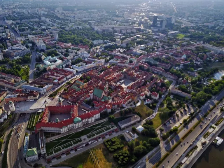


Warsaw between the Vistula and the city center
The Vistula forms a broad reference point in the aerial photographs of Warsaw. Behind the bank, the houses and streets of the Polish capital extend far into the country. From a narrower perspective, individual high-rise buildings emerge without losing the city's location on the river.
The river in the city panorama
In Warsaw, the Vistula gives the skyline a broad foreground. A picture with a recognizable bank also shows how far the taller houses are from the open water area.
At the river it is worth taking a second look at both edges of the picture. Sometimes a road ends there and continues along the water in the next section. In another place, a line of trees frames a stretch of bank. Such clues connect the place with its river valley. For a double page spread, you can choose an overview showing the course and juxtapose it with a close-up view of the shore. It helps if at least one bend in the bank or a building can be found in both motifs.
The silhouette from a closer look
In tall buildings, the silhouette changes with every viewing angle. Two towers that stand close together from one direction reveal a wide gap from another perspective. In a shot for a city performance, such a gap helps to recognize individual buildings. A piece of surroundings at the foot of the houses is equally important. It shows how the large buildings arrive in the street space and what scale neighboring buildings, squares or traffic systems have in comparison.
What the roofs reveal about the floor plan
A city center can often be read by its roofs. Where narrow gables are close together, the street space is also divided into short sections. A large, connected building interrupts this sequence. In the aerial photo you can follow the direction of an alley from such an interruption. For an illustration in a smaller format, a section with just a few easily distinguishable roof groups is worthwhile. In a large print, however, the spaces and small changes in direction are allowed to keep their place.
The distribution of blue tones
For a direct image comparison, use shot 14 and shot 6 from the gallery with 24 aerial photos. In the first excerpt, shades of blue play a smaller role. In the second shot, blue areas take up more space. Blue can extend over a large contiguous area or only appear in individual parts. What also counts for the effect is whether these areas extend to the edge of the picture or surround the main subject.
According to camera data, shot 24 and shot 13 were taken on June 19, 2017. There is a gap of around 13 minutes between the two images. The exposure time for the first of the images mentioned was 3/1457 second and for the second 13/11649 second.
Explain the course of the river in the picture
For a publication about a river, it is worth explicitly naming the bank side if it is known. The left side of the photo and the left bank of the river are two different details. The photo can look in any direction, the bank name follows the direction of flow. Anyone who describes a desired view to the aerial photographer can therefore orientate themselves on a bridge, a settlement or an easily identifiable section of the bank. The same reference points make it easier for the reader to orient themselves later when the river appears to be going in a different direction in the next shot.
Related motifs in the aerial photo archive
The article Vilnius offers another perspective. On the banks of the Neris, wide streets and modern high-rise buildings meet more open river areas in Vilnius. In the gallery Riedlingen there is a different focus. In Riedlingen, the red roofs of the old town are close to the water.
Aerial photos of Warsaw
Your aerial photographer across Europe
Request a free quote