 F4LUFTBILDER
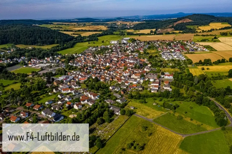


Allendorf in the Lumda valley
The town views of Allendorf an der Lumda combine a dense center with loosely built-up peripheral areas. Meadows and wooded slopes limit the field of vision in the distance. This means that the course of the valley remains legible even if the small river is barely visible in the image.
The Lumda Valley as a frame
Depending on the viewing height, Allendorf an der Lumda appears as a compact place or as part of a longer valley settlement. A piece of slope and the adjoining meadows help to differentiate. They show the direction in which the Lumda valley continues.
The location in a valley is made clear in the aerial photo by the lateral boundaries. A nearby slope pushes forward in front of a distant one, and the valley floor opens up in between. If the section is too narrow, it can easily give the impression of a flat surface. A shot with a bit of a slope at the edge of the image preserves the context. Orientation is particularly successful when there is also a familiar size comparison, such as a street or a house. The eye can then better assess the depth between the individual landscape levels.
How the place changes from the inside out
A village view needs a comprehensible starting point. This can be an intersection, a prominent group of houses or the end of a street. From there, the paths to the outskirts of town can be more easily followed in the image. When publishing for readers from outside, a brief location information in the caption helps. Resident viewers are often interested in another level. They are looking for the location of a house, the route of their route to school or a familiar open space between buildings.
Preserve open land in the picture
A meadow may look almost empty in a small preview. The larger view shows paths, individual shadows or transitions to neighboring properties. As a foreground, it creates distance before the view reaches the houses or the next slope. This distance is often an important part of the composition in landscape photos. If it is pruned too much, the development will appear denser. A deliberately wider section, on the other hand, shows what space the open land actually takes up.
The distribution of blue tones
To switch between two of the 10 aerial photos, shot 3 and shot 5 can be called up directly in the gallery. In the first excerpt, shades of blue play a smaller role. In the second shot, blue areas take up more space. Blue can extend over a large contiguous area or only appear in individual parts. What also counts for the effect is whether these areas extend to the edge of the picture or surround the main subject.
Shot 1 and Shot 10 are among the views from July 18, 2019. According to the camera's time information, there are approximately 4 minutes between the two images. The exposure time was 1/800 second for the first of the images mentioned and 1/640 second for the second.
A moving view is also available. The clip “Allendorf Lumda in Hesse from above” can be found under Aerial videos. The linked preview leads to inclusion in the aerial photographer's portfolio on Adobe Stock.
Select landforms for a landscape portrait
A single contour line can shape the impression of a landscape and yet reveal little about its extent. For a printed panorama, it is worth looking at the widest view first and then at a section of the same area. In a small format, a foreground with a clear contour can become more important than the most distant peak. If you plan a new view with an aerial photographer, you can make this decision based on the intended page layout and clarify in advance which part of the landscape definitely belongs in the picture.
Related motifs in the aerial photo archive
Two additional views can be used in the archive for comparison. The first can be found under Asmushausen. The houses in Asmushausen are spread out in small groups between meadows and slopes. The second belongs to the article Obersinn. At Obersinn, the houses lie like a narrow band between meadows and wooded heights.