 F4LUFTBILDER
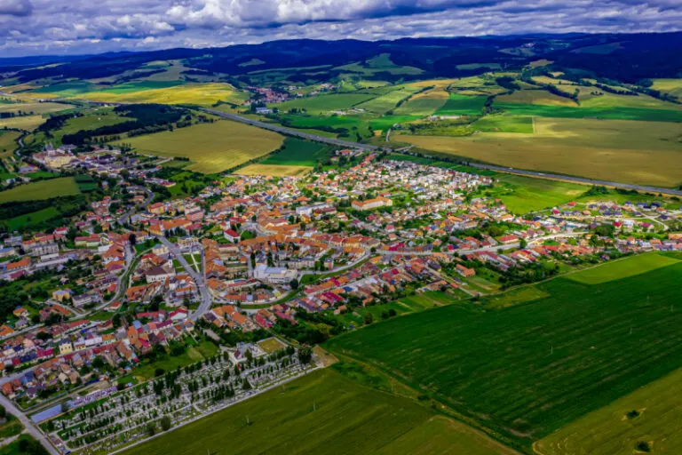


Spišské Podhradie in the open basin
Spišské Podhradie in Spiš, Slovakia, can be seen from afar due to its dense town center. When you take a closer look, streets and squares fan out. The overview with field areas in the foreground helps to distinguish the site from the neighboring, high-lying castle motif.
The city below the castle landscape
At Spišské Podhradie the place initially appears as a group of roofs in an open basin. A picture showing the surrounding heights explains how the buildings are distributed on the valley floor.
The center of a town can often be recognized from the air by the intersection of several streets. These lines diverge towards the open landscape, the properties become longer and the distances between the houses become larger. Anyone who chooses an image for a location portrait can pay attention to these transitions. A motif with a piece of the surrounding area tells where the place is. A narrower shot, on the other hand, gives people who live or have lived here more opportunities to find familiar buildings in the picture.
What the roofs reveal about the floor plan
If you look at it at an angle, the houses not only show their roofs, but also their facades of different widths. This gives the motif more depth than in the pure top view. Even the change from a low neighboring building to a taller building reveals something about the gradation of the place. Such a view is particularly useful for a local chronicle if the caption indicates the starting point of the view. Readers can then follow the rows of houses themselves to the edge of the picture.
Recognize the shape of the valley area
The location in a valley is made clear in the aerial photo by the lateral boundaries. A nearby slope pushes forward in front of a distant one, and the valley floor opens up in between. If the section is too narrow, it can easily give the impression of a flat surface. A shot with a bit of a slope at the edge of the image preserves the context. Orientation is particularly successful when there is also a familiar size comparison, such as a street or a house. The eye can then better assess the depth between the individual landscape levels.
The distribution of blue tones
To switch between two of the 14 aerial photos, shot 8 and shot 13 can be called up directly in the gallery. In the first excerpt, shades of blue play a smaller role. In the second shot, blue areas take up more space. Blue can extend over a large contiguous area or only appear in individual parts. What also counts for the effect is whether these areas extend to the edge of the picture or surround the main subject.
Shot 1 and Shot 14 are among the views from July 9, 2020. According to the camera's time information, there are approximately 6 minutes between the two images. ISO 100 and an exposure time of 1/400 second are recorded for both files.
A moving view is also available. The clip “Spisske Podhradie” can be found under Aerial videos. The linked preview leads to inclusion in the aerial photographer's portfolio on Adobe Stock.
A townscape for chronicle and community
Anyone who wants to show their family their place of origin often first looks for their own house in the aerial photo. When publishing for the community, the task is different. Even a non-local reader should be able to easily follow the path from the core to the landscape. An aerial photographer can start from the same terrain for both purposes and choose the section differently. What counts for the family portrait is the recognizability of a specific property. When it comes to the townscape, however, it is worth adding a little more surrounding area, even if it means that the individual roof appears smaller.
Related motifs in the aerial photo archive
Two additional views can be used in the archive for comparison. The first can be found under Slovakia – Spis Castle. Spiš Castle, also known as Spiš Castle, stretches over a wide hill. The second belongs to the article Slovakia – Strecno Castle. Strečno lies on a steep rock above the Waag.
Aerial photos of Spisske Podhradie
Your aerial photographer across Europe
Request a free quote