 F4LUFTBILDER
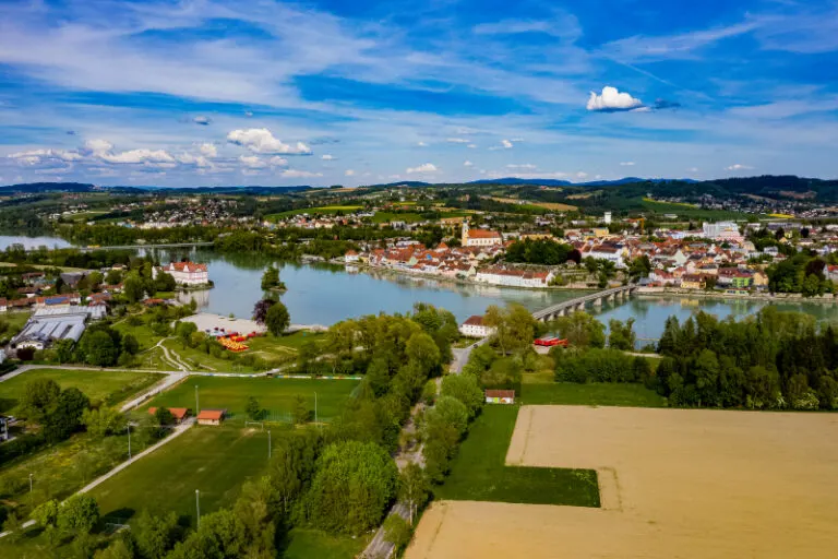


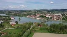
Schärding's roofs on the Inn
In Schärding, the rows of houses reach the Inn on a long strip of bank. The wide view captures the city and the open water area together. In closer shots, the arrangement of the roofs and the streets on the banks of the Austrian city give their own look.
The city from the direction of the Inn
In Schärding, the roofs along the Inn offer a natural reading direction. The bridge interrupts it and opens the view from one side of the bank to the other.
At the river it is worth taking a second look at both edges of the picture. Sometimes a road ends there and continues along the water in the next section. In another place, a line of trees frames a stretch of bank. Such clues connect the place with its river valley. For a double page spread, you can choose an overview showing the course and juxtapose it with a close-up view of the shore. It helps if at least one bend in the bank or a building can be found in both motifs.
What the roofs reveal about the floor plan
If you look at it at an angle, the houses not only show their roofs, but also their facades of different widths. This gives the motif more depth than in the pure top view. Even the change from a low neighboring building to a taller building reveals something about the gradation of the place. Such a view is particularly useful for a local chronicle if the caption indicates the starting point of the view. Readers can then follow the rows of houses themselves to the edge of the picture.
Which shows the connection between both sides
In the overview, a bridge is initially a line that connects two separate areas. A closer look reveals differences between access, supporting structure and subsequent paths. For a photo series it is therefore worthwhile to include a view of the entire connection as well as a section with one of the bridgeheads. There, the integration into the terrain becomes particularly easy to understand. For comparison, both images can be oriented the same way so that the start and end of the route can be seen without additional explanation.
Warm tones within the series
For a direct image comparison, use shot 15 and shot 2 from the gallery with 18 aerial photos. In the second view, warm reds and browns have more weight than in the first. Red-brown and yellowish areas are particularly noticeable next to cooler surfaces. What is interesting when comparing is whether they are concentrated on a single object or appear spread out across the entire view.
According to camera data, Shot 1 and Shot 18 were taken on April 28, 2020. There is a gap of around 13 minutes between the two pictures. The exposure time was 1/400 second for the first of the images mentioned and 1/500 second for the second.
The Aerial Videos section supplements the photos with 4 clips. The photographs by the aerial photographer linked there include “Schärding Luftbilder”. The relevant video page on Adobe Stock can be opened using the respective preview.
Explain the course of the river in the picture
For a publication about a river, it is worth explicitly naming the bank side if it is known. The left side of the photo and the left bank of the river are two different details. The photo can look in any direction, the bank name follows the direction of flow. Anyone who describes a desired view to the aerial photographer can therefore orientate themselves on a bridge, a settlement or an easily identifiable section of the bank. The same reference points make it easier for the reader to orient themselves later when the river appears to be going in a different direction in the next shot.
Related motifs in the aerial photo archive
The article Passau offers another perspective. Passau's old town lies on a narrow headland between the Danube and the Inn. In the gallery Wernstein am Inn there is a different focus. In Wernstein am Inn, a pedestrian bridge leads across the wide expanse of water.
Aerial photos of Schärding
Your aerial photographer across Europe
Request a free quote