 F4LUFTBILDER
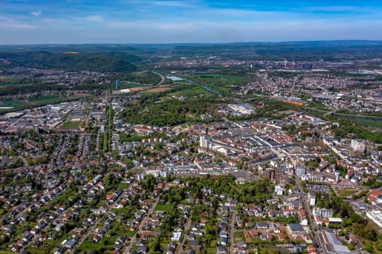


The Saar on the edge of Saarlouis
In the overview of Saarlouis, the Saar stands out as a quiet line next to the built-up areas. Trees and open spaces trace its course. Only a wide angle of view brings this river landscape and the more compact streets together in a single motif.
The Saar as a green outskirts of the city
The Saar is not the most noticeable part of every cityscape in Saarlouis. Only when the view hits a longer section of the bank does its significance for the spatial division become clear. That's why a river view complements a picture of the city center particularly well.
A river changes its role with the direction of view. Across the water you can clearly see how close the development is to the bank. A view along the run connects several sections that appear separate from the street. A particularly vivid image is one in which there is a prominent bank in the foreground and a second reference point further back. The eye can then follow the distance between them itself. A picture caption is achieved by indicating which side of the river the main motif is on.
What becomes visible on the edge of town
On the edge of town, several scales come together in a small section. On one side there are individual buildings with gardens and driveways. On the other hand, a single open area sometimes takes up as much space as several streets. This change can be shown in the picture over a common edge. A section in which the border between the two areas remains visible even when displayed narrowly is suitable for a website. The motif then retains its local reference even in the mobile view.
What the roofs reveal about the floor plan
A city center can often be read by its roofs. Where narrow gables are close together, the street space is also divided into short sections. A large, connected building interrupts this sequence. In the aerial photo you can follow the direction of an alley from such an interruption. For an illustration in a smaller format, a section with just a few easily distinguishable roof groups is worthwhile. In a large print, however, the spaces and small changes in direction are allowed to keep their place.
Shades of green in the image
If you browse through the 22 aerial photos, you can stay at shot 11 and shot 20 for a comparison. In the first image, green areas make up a smaller part of the section than in the second. It's worth tracking the green areas individually. Only in connection with neighboring forms does it become clear what is in the foreground and what belongs to the more distant surroundings.
For Shot 1 and Shot 22, the same day is noted in the image files, May 3, 2023. The recording times recorded are about 6 minutes apart. ISO 100 and an exposure time of 1/800 second are recorded for both files.
A moving view is also available. The clip “Saarlouis in Saarland from the air” can be found under Aerial videos. The linked preview leads to inclusion in the aerial photographer's portfolio on Adobe Stock.
Explain the course of the river in the picture
An image path along a body of water can follow the direction of flow. In order for readers to understand the transition between the local views, they need a recognizable reference point for each section. This can be a crossing or a significant bend. Whether water can still be seen on the left or right of the finished print also depends on the page format. It is therefore worthwhile for the aerial photographer to know whether a wide double page or a narrow single image is intended. A cut-off bend in the river can significantly change the view of the town.
Related motifs in the aerial photo archive
If you are looking for related motifs, you can start with Boppard. In Boppard the city spreads out along the Rhine. It's worth taking a second look at Miltenberg. Miltenberg stretches between the Main and a wooded slope.