 F4LUFTBILDER



Slimnic around the fixed height
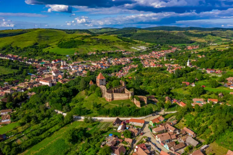
The remains of Slimnic's fortifications stand out above the trees in the town center. Red roofs follow the road, behind them the picture changes to meadows and fields. The Romanian town series shows a striking building and at the same time the landscape in which it stands.
The fortified height in the townscape
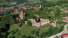
In Slimnic the paved height is right next to the houses. The arable land surrounding it gives the motif an open side, where the location of the ruins can be easily explained.
A ruin is visible from above in places where walls change direction or merge into open interior spaces. There you can follow the floor plan, even if only individual sections have been preserved. Growth and shadows are part of the visible situation. A careful description of the image names the recognizable parts without reconstructing missing buildings from their outline alone. In comparison with a closer picture, it also becomes clear where the large lines of the overview consist of several individual pieces of wall.
How the place changes from the inside out
A village view needs a comprehensible starting point. This can be an intersection, a prominent group of houses or the end of a street. From there, the paths to the outskirts of town can be more easily followed in the image. When publishing for readers from outside, a brief location information in the caption helps. Resident viewers are often interested in another level. They are looking for the location of a house, the route of their route to school or a familiar open space between buildings.
Field boundaries as a benchmark
On a map, fields become similar areas. In the aerial photo they differ in color, structure and processing direction. A bright dirt path divides two plots, a row of trees interrupts the straight lines. In such places, the size of the open hallway is better understood than by just looking at the horizon. Color changes should initially be left as an observation. Which crop is growing in a field or when it was cultivated can often only be determined from a single photo with additional local knowledge.
The distribution of blue tones
To switch between two of the 11 aerial photos, shot 5 and shot 10 can be called up directly in the gallery. In the first excerpt, shades of blue play a smaller role. In the second shot, blue areas take up more space. Blue can extend over a large contiguous area or only appear in individual parts. What also counts for the effect is whether these areas extend to the edge of the picture or surround the main subject.
Shot 1 and Shot 11 are among the views from July 13, 2020. According to the camera's time information, there are approximately 6 minutes between the two images. The exposure time was 1/500 second for the first of the images mentioned and 1/800 second for the second.
The Aerial Videos section supplements the photos with 3 clips. The photographs by the aerial photographer linked there include “The town of Slimnic in Romania from the air”. The relevant video page on Adobe Stock can be opened using the respective preview.
Communicate architecture and location together
Anyone who has visited a building themselves often remembers the entrance and the first view upwards. In the aerial photograph, these exact areas can disappear behind a roof or a wall. A suitable caption helps to connect the tour experienced with the spatial overview. For an aerial photographer, planned use is therefore a good starting point. A view for a site plan needs clear outer edges. An image for the cover page may focus more on the interaction between the building and its surroundings.
Related motifs in the aerial photo archive
Two additional views can be used in the archive for comparison. The first can be found under Oberdorla & Niederdorla. The gallery connects Oberdorla and Niederdorla with the fields and water areas in their surrounding area. The second belongs to the article Arnstein. Near Arnstein in Lower Franconia, residential areas, larger commercial roofs and open fields merge into one another.