 F4LUFTBILDER
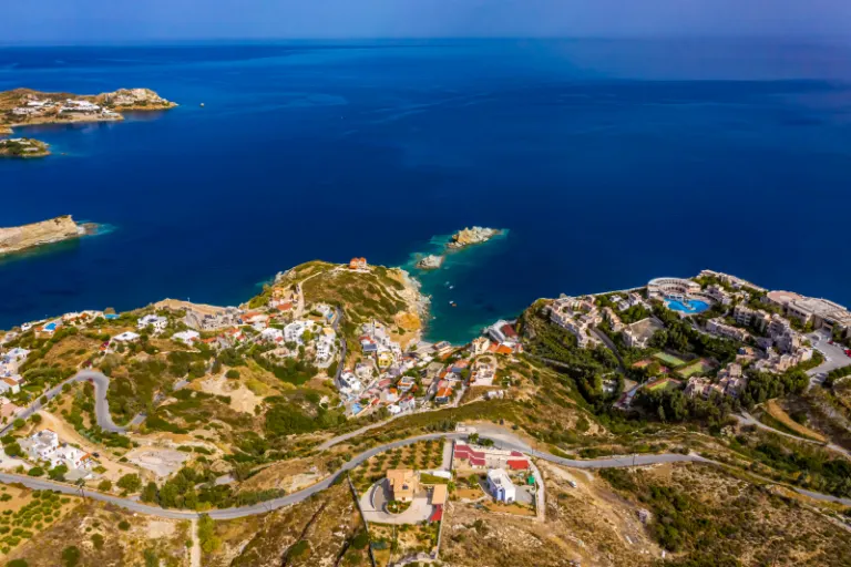


Mades with its small coastal inlets
In front of Mades, rocky outcrops divide the Cretan coast into small bays. In between there are bright roofs and narrow entrances to the water. The view from the land side emphasizes the depth of the cuts, the view from above shows their immediate neighborhood.
The coastline on a small scale
With Mades it is worth following the small incisions individually. Only further into the picture does it become apparent where a protrusion separates two neighboring sections of the same coast.
The two sides of a bay do not have to take up the same amount of space in an aerial photo. Often the closer headland obscures part of the opposite bank. A higher view opens up the space in between and shows the transition to open water. This makes a second view particularly valuable for depicting the location. While one image explains the location on the coast, the other can show the sheltered interior area, where the course of the shore and the use of the land are more clearly visible.
The shape of the rock in the light
Rock surfaces are often harder to read in an aerial photograph than their sharp outline suggests. A dark area can be a deep crevice or just in shadow. The connection of several visible edges provides information. Where they converge and cover a surface, a spatial jump is understandable. A location with clear rock contours is suitable for publication with smaller images. In a larger format, the eye can wander more over the finer differences in the surface.
How the place changes from the inside out
The center of a town can often be recognized from the air by the intersection of several streets. These lines diverge towards the open landscape, the properties become longer and the distances between the houses become larger. Anyone who chooses an image for a location portrait can pay attention to these transitions. A motif with a piece of the surrounding area tells where the place is. A narrower shot, on the other hand, gives people who live or have lived here more opportunities to find familiar buildings in the picture.
The distribution of blue tones
To switch between two of the 5 aerial photos, shot 2 and shot 5 can be called up directly in the gallery. In the first excerpt, shades of blue play a smaller role. In the second shot, blue areas take up more space. Blue can extend over a large contiguous area or only appear in individual parts. What also counts for the effect is whether these areas extend to the edge of the picture or surround the main subject.
Shot 1 and Shot 5 are among the views from October 7, 2020. According to the camera's time information, there are approximately 2 minutes between the two images. The exposure time was 1/800 second for the first of the images mentioned and 1/400 second for the second.
Select the coastal view for a photo series
In a coastal view, water is both a motif and an open space. Whether a large piece of sea remains in the picture depends on the story. When reporting on the shoreline, it holds different landforms together. For a portrait of a coastal town, the development may need more space. An aerial photographer can take this difference into account when choosing the angle of the image. When publishing, it's worth taking a final look at the final format so that a headland or riverside path at the edge isn't accidentally cut off.
Related motifs in the aerial photo archive
Two additional views can be used in the archive for comparison. The first can be found under Agia Pelagia – Crete. At Agia Pelagia the houses follow the bay that extends deep into the land. The second belongs to the article Ligaria – Crete. In the aerial photos, the bay of Ligaria is framed by an almost closed semicircle of buildings and rising terrain.