 F4LUFTBILDER
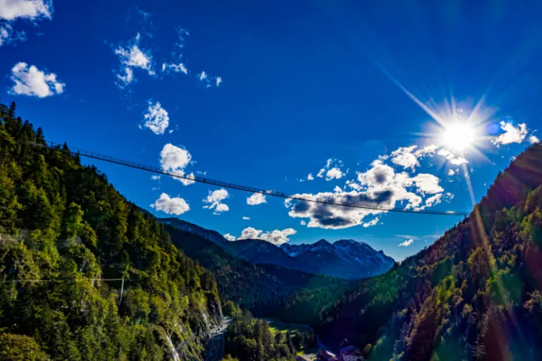


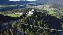
The highline179 cable suspension bridge in the valley area
The highline179 stretches as a thin line across the wooded terrain near Reutte. In the wide aerial view, the eye first finds the two sides of the valley and only then the narrow footbridge. This makes it clear, even without numbers, which route the suspension bridge covers.
A narrow connection over the valley
With the highline179, the free space under the bridge is a separate part of the motif. With both valley sides in the picture, it becomes clear how far the narrow structure covers.
In the overview, a bridge is initially a line that connects two separate areas. A closer look reveals differences between access, supporting structure and subsequent paths. For a photo series it is therefore worthwhile to include a view of the entire connection as well as a section with one of the bridgeheads. There, the integration into the terrain becomes particularly easy to understand. For comparison, both images can be oriented the same way so that the start and end of the route can be seen without additional explanation.
What the treetops reveal
A forest changes the view of every structure and every path that lies on its edge. From one side the treetops cover the lower area, from another a small gap opens. Photos in which the boundary between open space and vegetation can be clearly seen are particularly interesting. They explain which parts of a motif are visible. In a description, it is possible to distinguish precisely between the section depicted and the terrain hidden by the foliage.
Recognize the shape of the valley area
The location in a valley is made clear in the aerial photo by the lateral boundaries. A nearby slope pushes forward in front of a distant one, and the valley floor opens up in between. If the section is too narrow, it can easily give the impression of a flat surface. A shot with a bit of a slope at the edge of the image preserves the context. Orientation is particularly successful when there is also a familiar size comparison, such as a street or a house. The eye can then better assess the depth between the individual landscape levels.
The distribution of blue tones
To switch between two of the 5 aerial photos, Shot 3 and Shot 1 can be called up directly in the gallery. In the first excerpt, shades of blue play a smaller role. In the second shot, blue areas take up more space. Blue can extend over a large contiguous area or only appear in individual parts. What also counts for the effect is whether these areas extend to the edge of the picture or surround the main subject.
Shot 1 and Shot 5 are among the views from September 27, 2020. According to the camera's time information, there are approximately 2 minutes between the two images. The exposure time was 1/1000 second for the first of the images mentioned and 1/400 second for the second.
A moving view is also available. The clip “highline179 rope suspension bridge from the air” can be found under Aerial videos. The linked preview leads to inclusion in the aerial photographer's portfolio on Adobe Stock.
Explain the course of the river in the picture
An image path along a body of water can follow the direction of flow. In order for readers to understand the transition between the local views, they need a recognizable reference point for each section. This can be a crossing or a significant bend. Whether water can still be seen on the left or right of the finished print also depends on the page format. It is therefore worthwhile for the aerial photographer to know whether a wide double page or a narrow single image is intended. A cut-off bend in the river can significantly change the view of the town.
Related motifs in the aerial photo archive
Two additional views can be used in the archive for comparison. The first can be found under Ehrenberg Castle Ruins. From the Ehrenberg castle ruins, the view sweeps over a wide valley in Tyrol. The second belongs to the article Hohenschwangau Castle. The yellow building of Hohenschwangau Castle stands out clearly from the darker forest in the aerial photo.