 F4LUFTBILDER





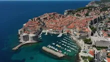
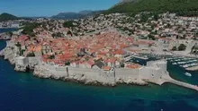
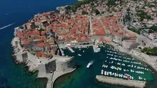
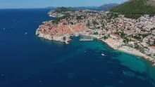
Dubrovnik's city walls on the Adriatic
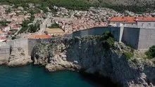
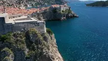
In Dubrovnik, the red roof of the old town stands out clearly from the Adriatic. The city wall follows the rocks close to the surf. From above, the changes in direction and the narrow streets behind them can be seen together without losing sight of the coastal location.
The city within its walls
In Dubrovnik, the city wall is both the outline and the accessible border of the old town. The red roofs inside give it a particularly clearly visible opposite side in the picture.
You can usually only see the next side of a wall on the ground. From the air, several changes of direction are visible at the same time. The transition from a straight stretch to a corner or goal area is particularly revealing. It gives the image a tangible reference point. If you want to show the outer contour, leave some space in front of and behind the border in addition to the wall. This makes it clear which areas belong together and where the view extends into the adjacent terrain.
What the roofs reveal about the floor plan
If you look at it at an angle, the houses not only show their roofs, but also their facades of different widths. This gives the motif more depth than in the pure top view. Even the change from a low neighboring building to a taller building reveals something about the gradation of the place. Such a view is particularly useful for a local chronicle if the caption indicates the starting point of the view. Readers can then follow the rows of houses themselves to the edge of the picture.
The coastline as orientation
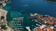
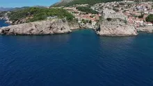
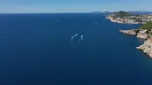
At the sea, the direction of view changes the picture even over a short distance. If you look almost parallel to the coast, you will see ledges and bays one behind the other. From a steeper view, the actual contour of the bank is easier to follow. A piece of open water can deliberately remain in the cutout. It gives the land a recognizable outer edge and creates distance between two shapes extending into the sea. In a publication, an indication of the location together with the name of the visible stretch of coast helps to classify this view more precisely.
Warm tones within the series
To switch between two of the 37 aerial photos, shot 11 and shot 36 can be called up directly in the gallery. In the second view, warm reds and browns have more weight than in the first. Red-brown and yellowish areas are particularly noticeable next to cooler surfaces. What is interesting when comparing is whether they are concentrated on a single object or appear spread out across the entire view.
Shot 37 and Shot 1 are among the views from August 20, 2020. According to the camera's time information, there are approximately 22 minutes between the two images. ISO 100 and an exposure time of 1/1250 second are recorded for both files.
In the Aerial Videos section there are 13 clips for this article. An example is “Dubrovnik from the air”. Its preview leads directly to the video in the aerial photographer's Adobe Stock portfolio.
Communicate architecture and location together
Anyone who has visited a building themselves often remembers the entrance and the first view upwards. In the aerial photograph, these exact areas can disappear behind a roof or a wall. A suitable caption helps to connect the tour experienced with the spatial overview. For an aerial photographer, planned use is therefore a good starting point. A view for a site plan needs clear outer edges. An image for the cover page may focus more on the interaction between the building and its surroundings.
Related motifs in the aerial photo archive
Two additional views can be used in the archive for comparison. The first can be found under Spain – Cadiz. In Cádiz, bright roof terraces and fortress walls directly adjoin the water surface. The second belongs to the article Durres. In Durrës, long piers reach out into the Adriatic.