 F4LUFTBILDER
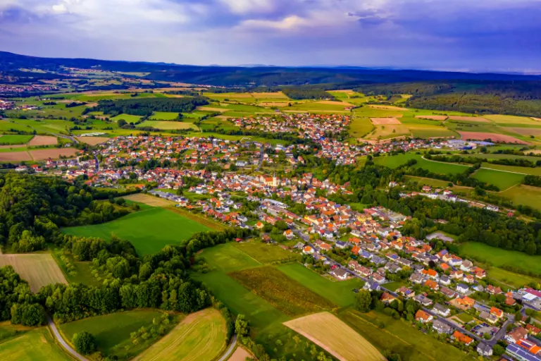


Burkardroth and its neighborhood in the valley
The aerial photos show the community of Burkardroth in the Rhön. An elongated settlement area divides the field. The slopes on both sides remain clearly visible and turn the view over the roofs into a landscape portrait.
A local band between the slopes
At Burkardroth, the direction of the valley dictates the view. The sequence of houses and fields appears much more closed when viewed lengthwise than when viewed across the town.
A village view needs a comprehensible starting point. This can be an intersection, a prominent group of houses or the end of a street. From there, the paths to the outskirts of town can be more easily followed in the image. When publishing for readers from outside, a brief location information in the caption helps. Resident viewers are often interested in another level. They are looking for the location of a house, the route of their route to school or a familiar open space between buildings.
Recognize the shape of the valley area
The location in a valley is made clear in the aerial photo by the lateral boundaries. A nearby slope pushes forward in front of a distant one, and the valley floor opens up in between. If the section is too narrow, it can easily give the impression of a flat surface. A shot with a bit of a slope at the edge of the image preserves the context. Orientation is particularly successful when there is also a familiar size comparison, such as a street or a house. The eye can then better assess the depth between the individual landscape levels.
Field boundaries as a benchmark
From a greater height, the field appears to be an orderly floor plan. A closer look shows how the paths change direction at curves, embankments and property boundaries. When selecting images, it is helpful to preserve at least one of these transition points. It turns a colored area into a piece of actually used landscape. For an article about the surrounding area, even the inconspicuous edge of a field can explain more than a wide section that only shows numerous plots as small spots.
Warm tones within the series
Among the 5 photos in the gallery, shot 3 and shot 2 provide a good starting point for the comparison. In the second view, warm reds and browns have more weight than in the first. Red-brown and yellowish areas are particularly noticeable next to cooler surfaces. What is interesting when comparing is whether they are concentrated on a single object or appear spread out across the entire view.
The camera captured September 16, 2020 for shot 1 and shot 5. The time interval between these two views is approximately 2 minutes. The exposure time was 1/200 second for the first of the images mentioned and 1/240 second for the second.
A townscape for chronicle and community
For a local chronicle, the outer edge of the development is just as interesting as the middle. That's often where things change first. A meadow becomes a building site, a driveway is given a new route, a single house disappears behind the larger trees. If you want to talk about the same place again later, a dated overall view is helpful. You can agree with the aerial photographer on a point that should remain in the image when repeated. A street intersection is usually better suited for this than a moving object on the side of the road.
Related motifs in the aerial photo archive
Two further articles invite comparison. In the first, Middle Sense, another detail is in the foreground. Mittelsinn fits into the wide green valley floor of Sinn. Then Geroda comes in handy. The development of Geroda stretches between meadows and fields through a shallow valley.