 F4LUFTBILDER
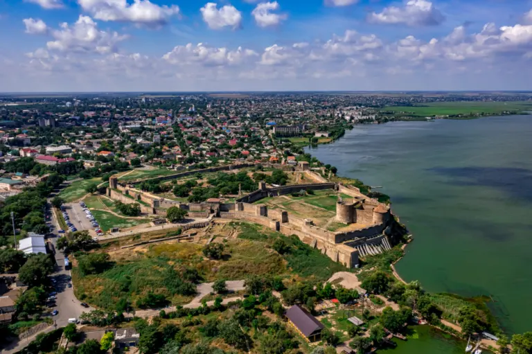


The Akkerman fortress on the shore
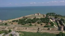
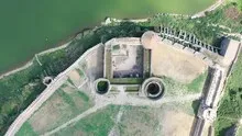
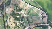
The walls of Akkerman separate an extensive fortress area from the water on one side and the buildings on the other. The different farms stand out clearly in the overview. A narrower section shows how towers structure the course of the outer wall.
Rings of walls between the city and the water
The water gives Akkerman Fortress a particularly clear outer edge. On the land side, however, the lines of the wall can be followed along neighboring paths and built-up areas.
The system can be told from two distances. The overview first clarifies how much space the building takes up on its hill or on the bank. The view then turns to a characteristic corner, the transition between two wings or the opening to a courtyard. This order is clear for an editorial article because readers can find the detailed section on the overview image. This is particularly helpful when multiple towers or wall edges obscure each other in a single view.
Follow the course of the border
You can usually only see the next side of a wall on the ground. From the air, several changes of direction are visible at the same time. The transition from a straight stretch to a corner or goal area is particularly revealing. It gives the image a tangible reference point. If you want to show the outer contour, leave some space in front of and behind the border in addition to the wall. This makes it clear which areas belong together and where the view extends into the adjacent terrain.
Light and surface of the water
On water, colors and brightness change with the direction of the light. A bright spot can be a reflection, a darker stripe can be caused by the shadow on the bank. The easiest way to describe such differences is to use a solid bank edge or an object in the water as a comparison. Two different distances are attractive for a sequence of images. The closer view shows small surface structures, while the overview makes their location in the entire water surface understandable.
Shades of green in the image
If you browse through the 19 aerial photos, you can stay at shot 10 and shot 15 for a comparison. In the first image, green areas make up a smaller part of the section than in the second. It's worth tracking the green areas individually. Only in connection with neighboring forms does it become clear what is in the foreground and what belongs to the more distant surroundings.
For Shot 1 and Shot 19, the same day is noted in the image files, August 5, 2021. The recording times recorded are approximately 14 minutes apart. The exposure time was 1/500 second for the first of the images mentioned and 1/400 second for the second.
The Aerial Videos section supplements the photos with 4 clips. The aerial photographer's photographs linked there include “Akkerman Fortress in the Ukraine”. The relevant video page on Adobe Stock can be opened using the respective preview.
Communicate architecture and location together
Anyone who has visited a building themselves often remembers the entrance and the first view upwards. In the aerial photograph, these exact areas can disappear behind a roof or a wall. A suitable caption helps to connect the tour experienced with the spatial overview. For an aerial photographer, planned use is therefore a good starting point. A view for a site plan needs clear outer edges. An image for the cover page may focus more on the interaction between the building and its surroundings.
Related motifs in the aerial photo archive
If you are looking for related motifs, you can start with Weißensee (Thuringia). In Weißensee, the walls and red roofs of the castle area stand out clearly between the greenery and residential buildings. It's worth taking a second look at Sümeg Castle. In Sümeg, the slopes carry the castle well above the surrounding buildings.